GS Paper III
News Excerpt:
Relief material worth $1 million is being sent as immediate assistance to Papua New Guinea after a recent landslide in the country’s Enga province.
More about the news:
- As per reports from the country, the landslide resulted in over 2,000 deaths.
- Ongoing search and rescue operations are facing significant challenges.
- Secondary slides and rock falls complicate efforts in the search area, exacerbated by limited access to heavy digging equipment and obstructed roads.
- The manner in which landslides sweep away buildings and their occupants is making it difficult to locate potential survivors.
- India has sent 19 tonnes of humanitarian and disaster relief (HADR) materials to Papua New Guinea.
- Papua New Guinea is a member of the Forum for India-Pacific Islands Cooperation (FIPIC).
- India has been promoting cooperation with the Pacific island nations through FIPIC.
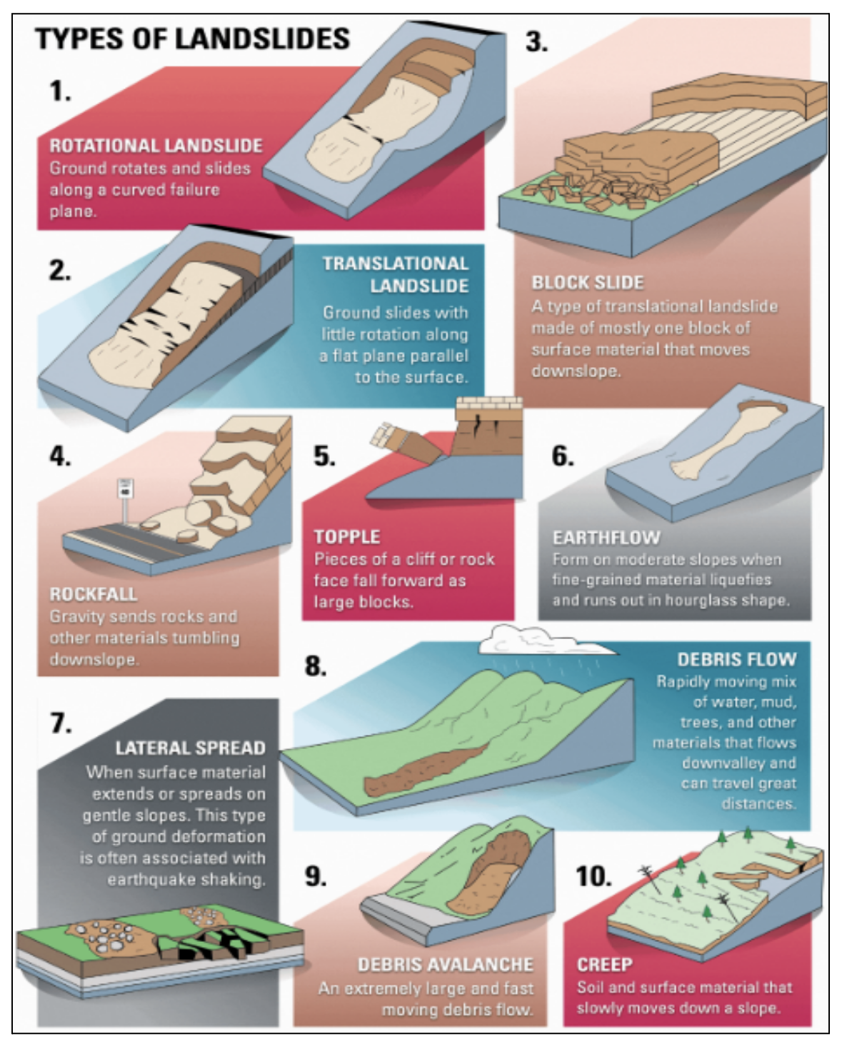
What is landslides?
- Landslides occur when the force of gravity overwhelms the strength of the geomaterial forming a slope, which can range from rocks to sand, silt, and clays.
- Secondary slides are subsequent landslides that occur after an initial landslide.
- They result from destabilized conditions caused by the primary slide, such as unstable debris, ongoing heavy rainfall, erosion, or disturbed ground.
- These follow-up slides can happen without warning, posing additional risks to rescue operations and further damaging affected areas.
Causes of Landslides:
- Natural landslides are often triggered by earthquakes or heavy rainfall, or a combination of both.
-
- Earthquakes shake and weaken the ground over time, while rainwater seeps into porous soil, adding weight and reducing stability.
- Coastal slopes can also fail due to erosion from wave action.
- Human activities like deforestation and mining can further destabilise slopes.
- Tree roots that reinforce soil are removed, and ground vibrations from mining operations mimic earthquake effects.
Prediction Challenges:
- Predicting landslides is inherently difficult due to the complex interactions of geological factors and environmental conditions.
- Effective prediction would require accurate forecasts of earthquakes and rainfall patterns, alongside detailed knowledge of the strength and distribution of geomaterials within slopes.
- Current methods rely on limited data gathered from specific locations, making extrapolation to larger areas prone to error.
- Factors like existing fractures in rock masses, which weaken slopes, often go undetected, introducing uncertainties into predictive models.
Mitigation Challenges:
- Mitigating landslide risk involves understanding and mapping the three-dimensional structure and strength of geomaterials in slopes.
- This requires advanced geological and geotechnical assessments, as well as the development of comprehensive risk maps.
- However, obtaining precise data across extensive terrain remains a major challenge.
- Additionally, the size of a landslide correlates with its runout distance.
- Accurately predicting the exact magnitude and timing of a landslide remains elusive, akin to forecasting weather or seismic activity.
|
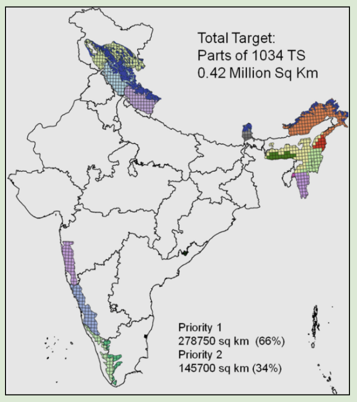
Landslides in India
|