News Excerpt:
An Atlantis-like supercontinent named Sahul, which was visibly above the Earth's surface around 7,000 decades ago, has been recently discovered by archeologists.
About the news:
What is Sahul?
- It can be termed as a supercontinent, which stood exposed on the Earth's surface during the Pleistocene epoch when Earth was in the midst of the last ice age.
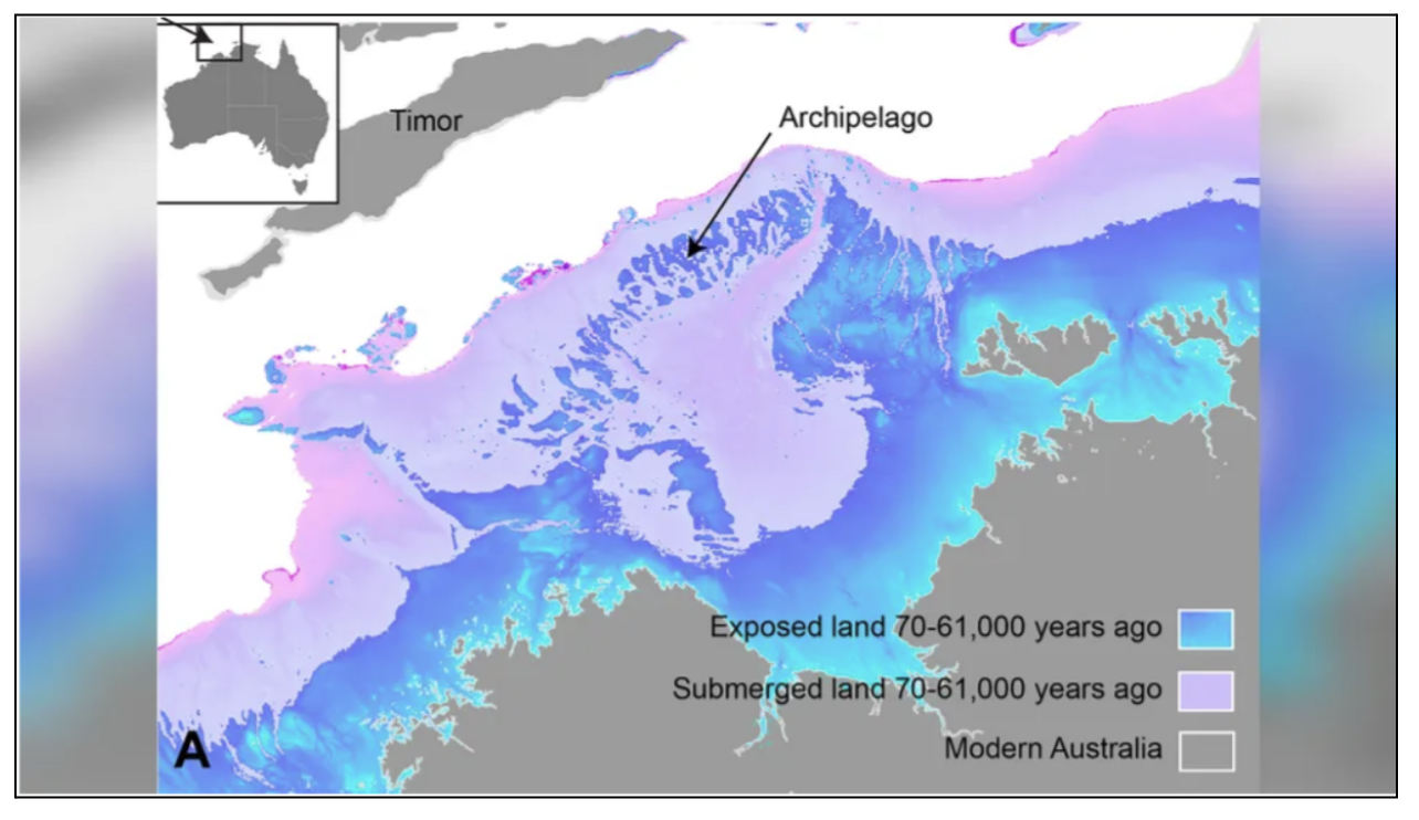
- Since the ice age led to glaciation of water levels on the planet, it exposed parts of land like Sahul which connected to currently known Australia to Papua New Guinea in the north and Tasmania in the south, according to The Sun's report.
- The undersea territory was so large it could have functioned as a stepping stone for migration from modern-day Indonesia to Australia.
- It reveals how Australia's first inhabitants migrated across Sahul before it became modern-day Australia.
- These archeological locations help to depict when people migrated and moved quickly around the globe from one part of the land to another, under unfamiliar conditions in search of food and shelter during adverse times.
How did the researchers discover Sahul?
- Based on the available data and the reverse engineering of geological and environmental conditions, researchers were able to create a simulation of the landscape of Sahul between 75,000 and 35,000 years ago.
- Glaciation caused declining sea levels that exposed areas of submerged continental shelf connecting what is now mainland Australia to Papua New Guinea in the north and Tasmania in the south.
- Sea levels remained low for thousands of years at a time, but other geological and environmental conditions would have evolved over this period. For instance, there would have been changing rainfall patterns, shifting river courses, spreading or shrinking forests and grasslands, and sediment deposition. All of these factors would have influenced the characteristics of the terrain and, therefore, how humans explored it.
- The simulation also incorporated possible migration routes from two locations in Southeast Asia — West Papua and the Timor Sea Shelf — as well as archaeological sites spread across the modern-day landscape.
- Finally, the simulation incorporated estimates from "Lévy walk foraging patterns" — a type of movement that's commonly used by hunter-gatherers to find food in unfamiliar landscapes — which also helped to estimate the pace of migration.
- The new landscape evolution model allows for a more realistic description of the terrains and environments inhabited by the first hunter-gatherer communities as they traversed Sahul.
- The calculations showed that these intrepid humans likely traversed the landscape at a pace of about 1.15 kilometers per year, which the researchers say is relatively swift.
This study is the first to show the impact of landscape changes on the initial migration on Sahul, providing a new perspective on its archaeology. If such an approach is used in other regions as well, humans could improve the understanding of humanity's extraordinary journey out of Africa.